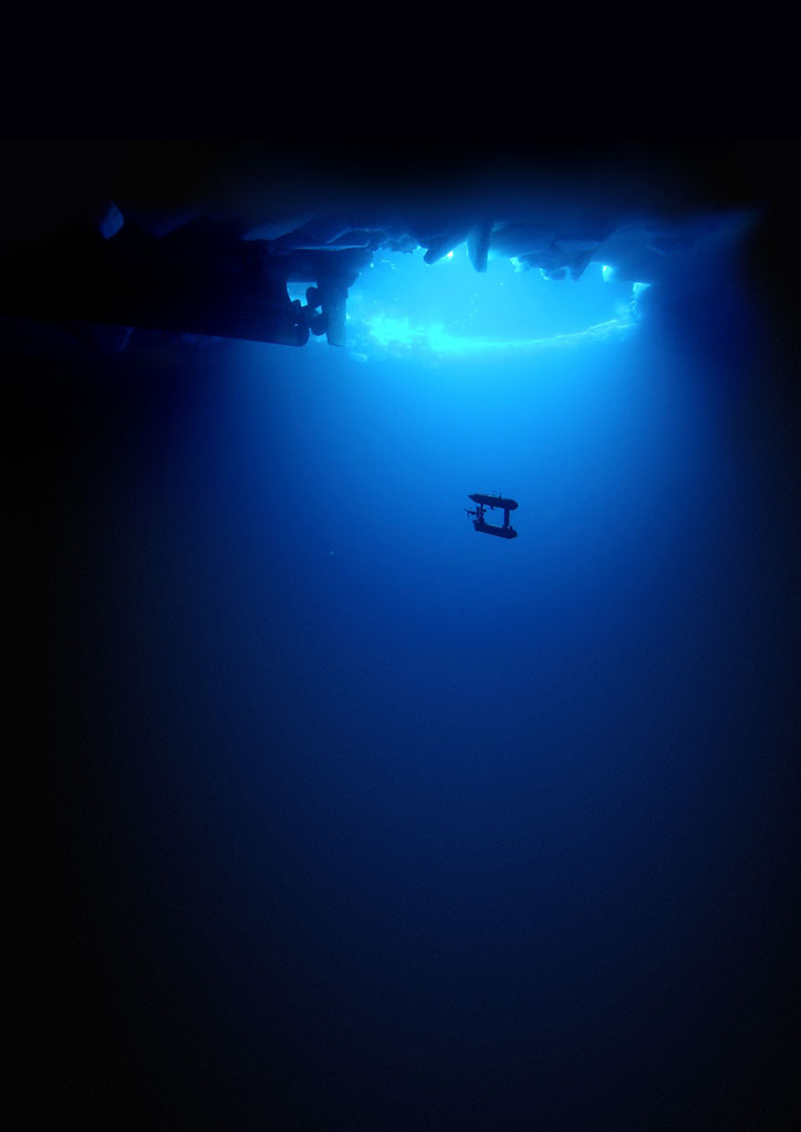
Scientists have for the first time managed to map some parts of the Antarctic ice sheet in 3D using a self-propelled submarine.
The submarine robot called SeaBED (Unmanned Underwater Vehicles (UUV)) has been busy beneath the ice, scanning it using a sonar and using satellite location tracking. As you all probably know, Antarctica is actually a continent landmass, but large parts of its ice extend over the ocean. And this ocean ice is what SeaBED aims to measure.
Thicker than Thought
The resulting data shows that the ice thicknesses cab measure up to 17 meters, but the scientists say that the average thickness of the Antarctic is thinner. The measurements have been made between 2010-2012 and data has been analyzed for around 500,000 square meter area for which the robot has surveyed.
The researchers conclude that the ice is actually thicker than was previously known. But even so, the scientists warns against drawing far-reaching conclusions as they have only surveyed a small area, and future measurements will tell if the ice if the ice is getting thinner, and at what rate.
The ice sheet in Antarctica is now the largest ever measured with modern satellite technology and the scientists now hope that the new method can be used to map the rest of the Antarctic ice. One of the researchers, Ted Maksym, writes in a press release, “What this effort does is show that observations from AUVs under the ice are possible and there is a very rich data set that you can get from them. This work is an important step toward making the kinds of routine measurements we need in order to really monitor and understand what’s happening with the ice and the large scale changes that are occurring.”
The Future
In the context of global warming, the distribution and amount of ice are an ever more urgent and important data to collect. It is especially interesting since scientists are still not sure why the Antarctic ice does not follow the same dramatic trend as its northern cousin the Arctic, for which the ice continues to melt ever more rapidly.
A possible explanation for this is that loss of UV-absorbing ozone may have cooled the stratosphere and strengthened the polar vortex. The polar vortex is a pattern of spinning winds around the South Pole and these winds act like an atmospheric barrier, preventing warmer, coastal air from moving into the continent’s interior. And a stronger polar vortex might explain the apparent cooling trend in the interior of Antarctica.
The mystery remains however until scientifically proven, but to reach an answer to the mystery has become increasingly important to the climate change debate still ongoing.
Quick facts on Antarctica:
Nearly all of continental Antarctica is covered by a sheet of ice that is on average at least 1.6 kilometers thick (1 mile)
Antarctica contains 90% of the world’s ice and more than 70% of its fresh water
The ice found on the Antarctic continent amounts to around 30 million cubic kilometers of ice
If all the land-ice covering Antarctica were to melt the seas would rise by over 60 meters worldwide
The average temperature in Antarctica is -37°C, so the ice there is in no danger of melting (contrary to the Arctic).
Most parts of the continent it never gets above freezing.
Check our the videos below by the Antarctic Survey.
_______________
Press Release – Underwater robot sheds new light on Antarctic sea ice
______________________________