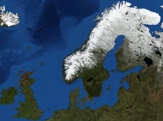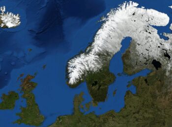
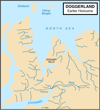
Doggerland is the name given to a former landmass in Europe that not so long ago resided in the North Sea.
It connected Great Britain to mainland Europe during and after the most recent Ice Age.
This immense landmass gradually disappeared due to rising sea levels but existed until about 7,000 years ago when it finally gave away to the Atlantic Ocean.
The landmass became an island and the island then ultimately disappeared as its highest peaks, the Doggerbank Hills, was the last to give way for the ocean.
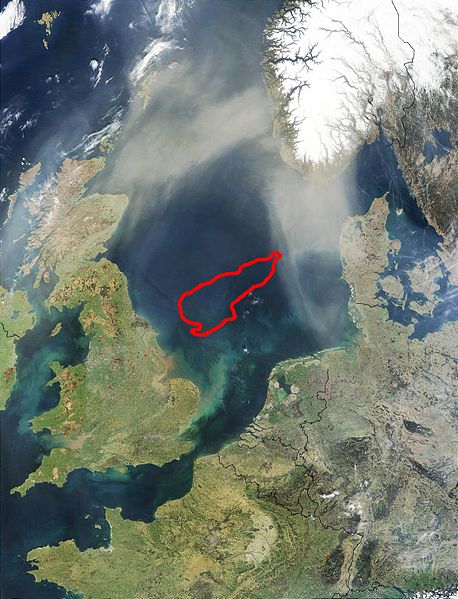
A team of British scientists has recently been able to map Doggerland using data collected from North Sea oil companies. And according to Richard Bates at St. Andrews University, the seabed indicates that great forests, deep rivers, and vast plains once characterized this prehistoric landmass.
The Mystery of a Stone Age Tool
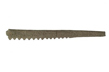
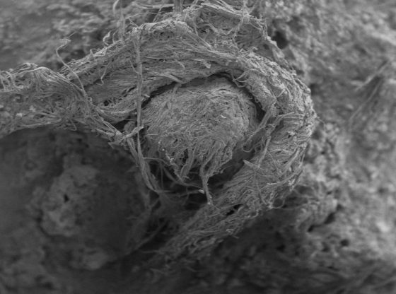
The archaeological potential of the area has been known since the early 1900s. Interest intensified in 1931 when a commercial trawler operating in the area accidentally dragged up a barbed antler point. And when it was later compared to other similar tools found on the British Isles, it was found to be a harpoon from the Stone Age and between 4,000 and 10,000 years old.
This was a prehistoric time when Europe was still inhabited by hunter-gatherer humans. Peoples who lived in small tribal groups and moved with the availability of edible animals and plants, across forests and plains, in accordance with the seasons and the movement of herd animals.
Back in 1931 however, the existence of a landmass in the North Sea was not yet established science. And archaeologists wondered how it could be that a Stone Age tool was found in the middle of the North Sea. They speculated that if these prehistoric peoples would have been able to cross the open sea in canoes. But as more findings followed, as later commercial vessels found plenty of remains from ancient animals such as the cave lion and the mammoth.
A Landbridge
Later, this whole area in the North Sea was to be recognized as a vanished land bridge. A land bridge that made it possible for early humans to populate the British Isles as the great continental ice sheet that covered Northern Europe began to thaw.
Doggerland thus provided a corridor by which Stone Age peoples was enabled to move between known settlements on the continent and the British Isles. Much like the now missing Bering land bridge that once connected Asia and North America.
Mapping the Seabed Reveals a Lost Land Rich in Animals and People
When scientists began working with oil companies and gain access to their precise measurements of the North Sea floor, they managed to slowly recreate what the lost landmass once looked like.
The researchers now believe that Doggerland once had a rich fauna of animals and was probably also home to thousands of prehistoric Europeans. The latter is an assumption based on many human-made tools that have been found on the seafloor, for example, arrowheads and barbed antler points.
Neanderthals probably also made the landmass their home. As the earliest Neanderthals found in Europe has been estimated to be about 350,000 years old and the last individual to between 25,000 and 28,000 years old.
The most recent glacial period and Ice Age lasted between 110,000 and 12,000 years ago. Since Neanderthals were living in Europe before the Ice Age, during this vast time, Doggerland and many other landmasses, most probably existed.
The Storegga Slide
At around 6,000 BCE a tsunami is believed to have hit the island. A tsunami that was a result of a collapsing undersea landslide just of the coast of Norway, the so-called, Storegga Slide. This landslide is one of the largest known to man. An immense area of about the size of neighboring Iceland collapsed and moved a vast amount of water.
There are plenty of evidence of this landslide from carbon dated plant materials along the costs of Norway and Scotland. The natural disaster gave rise to great weaves over 20 meters high as deposited sediments have been found up to 80 kilometers inland at Montrose Basin, the Firth, and Forth, in Scotland.
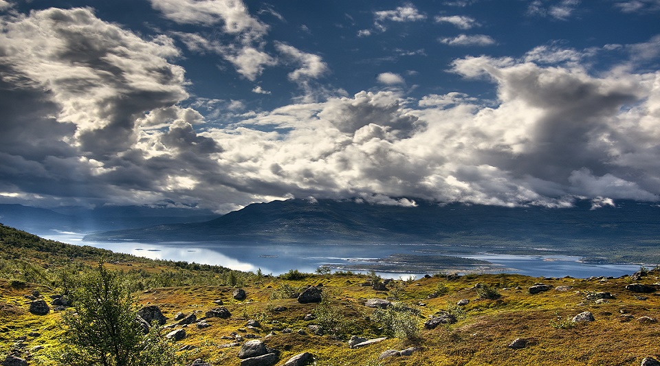
The scientist will continue to map and investigate the area and the sea floor and we will probably know a lot more about what Doggerland looked like in the future. With its wast valleys and forests, it truly is the Stone Age Atlantis.
Based on the knowledge we already have about Europe’s animals and plants from this period, it is not difficult to accurately guess what the land must have looked like. Bones and man-made bone-tools indicate that there were deer, roe deer, and wild boar. The rivers were probably full of freshwater fish such as perch and pike. Salmon may have migrated up the rivers to spawn each year. It was probably a landscape where we could have felt at home.
_______________
On the origin of the Dogger Bank, in the North Sea
The Doggerland project
______________________________