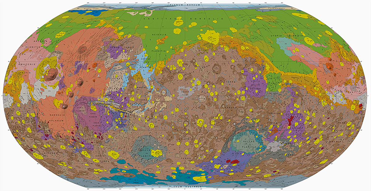
This stunning picture above is a new and very detailed map of the planet Mars. It is the most detailed map of Mars ever created.
It succeeds the previous geological map of Mars that was developed and has been in use since 1987, so it was probably about time for an update.
The new map was published by the U.S. Geological Survey (USGS) and was created by the agency using data from four orbiting spacecraft orbiting Mars for the last 16 years collecting imagery; the Mars Global Surveyor, Mars Odyssey, Mars Express, and the Mars Reconnaissance Orbiter.
These have provided morphologic, topographic, spectral, thermophysical and radar data of the planet. For example, the map uses more than 600 million individual altitude measurements.
The scientists behind this new map write in a published abstract (see below) that their work has been made possible with the aid of “unprecedented variety, quality, and quantity of remotely sensed data” captured by these three NASA and ESA spacecraft.
The new map will probably be helpful when selecting landing sites for upcoming Mars expeditions such as the ESA ExoMars and NASA InSight mission.
And with the current pace of private enterprise in space, who knows, perhaps we will see a private company landing on the red planet quite soon. After all, last month the inventor and entrepreneur Elon Musk said during an interview with CNBC that he hopes he can take humans to Mars within 10 years.
_______________
Geologic Map of Mars
______________________________